


Location and Design Division
L&D Home • Business Administration • CADD Support • GeoSpatial Program • Hydraulics and Utilities Project Management Office • Roadway Design and Special Projects • Standards, Special Design, Policy and Quality Assurance • Traffic Design • Water Resources Program
GeoSpatial Program
The GeoSpatial Program area is responsible for providing statewide photogrammetry services, technical support on survey policies and procedures, and maintaining state of the art surveying equipment. We manage the statewide on-call Survey contract, Subsurface Utility Engineering (SUE) contract and provide Survey CADD Support for the Department.
The Photogrammetry section provides aerial mapping and maintains an extensive library of imagery dating back until the 1930’s. The Photogrammetry section utilizes a terrestrial scanner to provide detailed and highly accurate 3D data for areas that may not be accessible.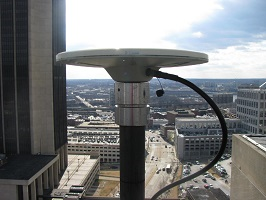
Brian Dresen, L.S.
State GeoSpatial Program Manager
VDOT- Location & Design Division
1401 East Broad Street, Richmond, VA. 23219
Brian.Dresen@VDOT.Virginia.gov
804-729-6339
Christopher E. Kelly, S.P.
State Photogrammetry Supervisor
Christopher.Kelly@VDOT.Virginia.gov
804-225-4201
Jack Griffin, L.S.
Supervisor Geodetic Surveys
Jack.Griffin@vdot.virginia.gov
804-869-8823
Michelle Fults, GISP
Geographic Information Systems (GIS) Supervisor
Michelle.Fults@VDOT.Virginia.gov
804-786-1294
Announcements
- No announcements at this time.
Sections
- Geographic Information Systems (GIS)
- Land Survey Technician Apprenticeship Program (LSTAP)
- Photogrammetry
- Survey Support